![](/images/other/stat-length.png)
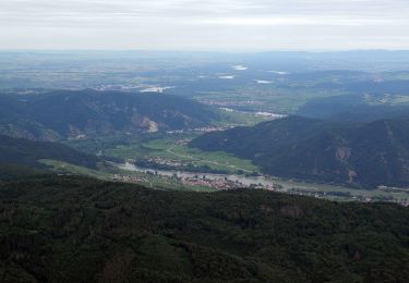
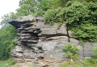
![Randonnée A pied Gemeinde Weißenkirchen in der Wachau - Spitz-Gruberwarte (gelb) - Photo](https://media.geolcdn.com/t/1900/400/235606d7-b03a-4078-977d-a39bcf19fae5.jpeg&format=pjpeg&maxdim=2)
Spitz-Gruberwarte (gelb)
SityTrail - itinéraires balisés pédestres
Tous les sentiers balisés d’Europe GUIDE+
![Longueur](/images/other/stat-length.png)
![Altitude max](https://static1.geolcdn.com/siteimages/upload/files/1508320355ic_sort_altitude_max_24dp.png)
![Dénivelé positif](https://static1.geolcdn.com/siteimages/upload/files/1508320355ic_sort_den_pos_24dp.png)
![Km-Effort](/images/other/stat-length.png)
![Altitude min](https://static1.geolcdn.com/siteimages/upload/files/1508320355ic_sort_altitude_min_24dp.png)
![Dénivelé négatif](https://static1.geolcdn.com/siteimages/upload/files/1508320355ic_sort_den_neg_24dp.png)
![Boucle](https://static1.geolcdn.com/siteimages/upload/files/16400158638029165_repeat_loop_refresh_sync_direction_icon.png)
![A pied](https://static1.geolcdn.com/sitytour/trail-icons/100.png)
1h01
Difficulté : Facile
![Scannez ce code QR pour ouvrir la randonnée dans l'application SityTrail](https://capi.geolives.com/qq0zvz2zws4bq2lad0pu/sitytour/trails/3128721/qr.png?size=200)
Application GPS de randonnée GRATUITE
À propos
Randonnée A pied de 3,2 km à découvrir à Basse-Autriche, Bezirk Krems, Gemeinde Weißenkirchen in der Wachau. Cette randonnée est proposée par SityTrail - itinéraires balisés pédestres.
Description
Der ÖTK gilt als Pionier des Fremdenverkehrs. Heute ist der ÖTK mit über 360 Kursen und geführten Touren in 50 Freizeitsportarten der größte Anbieter im Outdoor-Segment in Österreich.
Site web: https://www.oetk.at/
Localisation
Commentaires
Randonnées à proximité
![Randonnée A pied Gemeinde Rossatz-Arnsdorf - St. Lorenz - Seekopf - Photo](https://media.geolcdn.com/t/375/260/f7c3b641-ea5d-4a83-b625-32a4080e0569.jpeg&format=jpg&maxdim=2)
![A pied A pied](https://static1.geolcdn.com/sitytour/trail-icons/100.png)
A pied
![](/images/other/stat-length.png)
![](https://static1.geolcdn.com/siteimages/upload/files/16400158638029165_repeat_loop_refresh_sync_direction_icon.png)
![Randonnée A pied Gemeinde Weinzierl am Walde - Wolfenreith-Mühldorf - Photo](https://media.geolcdn.com/t/375/260/503345dc-36ce-4ac2-b4eb-c64d833be577.jpeg&format=jpg&maxdim=2)
![A pied A pied](https://static1.geolcdn.com/sitytour/trail-icons/100.png)
A pied
![](/images/other/stat-length.png)
![](https://static1.geolcdn.com/siteimages/upload/files/16400158638029165_repeat_loop_refresh_sync_direction_icon.png)
![Randonnée A pied Gemeinde Spitz - Spitz - Buschandlwand/Gruberwarte - Photo](https://media.geolcdn.com/t/375/260/235606d7-b03a-4078-977d-a39bcf19fae5.jpeg&format=jpg&maxdim=2)
![A pied A pied](https://static1.geolcdn.com/sitytour/trail-icons/100.png)
A pied
![](/images/other/stat-length.png)
![](https://static1.geolcdn.com/siteimages/upload/files/16400158638029165_repeat_loop_refresh_sync_direction_icon.png)
![Randonnée A pied Gemeinde Spitz - Rotes Tor Rundwanderung - Photo](https://media.geolcdn.com/t/375/260/c880dc64-65cd-498b-bb2f-39dd5bb6708b.jpeg&format=jpg&maxdim=2)
![A pied A pied](https://static1.geolcdn.com/sitytour/trail-icons/100.png)
A pied
![](/images/other/stat-length.png)
![](https://static1.geolcdn.com/siteimages/upload/files/16400158638029165_repeat_loop_refresh_sync_direction_icon.png)
![Randonnée A pied Gemeinde Spitz - Buchberg Rundwanderung - Photo](https://media.geolcdn.com/t/375/260/4796baa1-b9a2-42af-9e74-5dc91b432f87.jpeg&format=jpg&maxdim=2)
![A pied A pied](https://static1.geolcdn.com/sitytour/trail-icons/100.png)
A pied
![](/images/other/stat-length.png)
![](https://static1.geolcdn.com/siteimages/upload/files/16400158638029165_repeat_loop_refresh_sync_direction_icon.png)
![Randonnée A pied Gemeinde Weißenkirchen in der Wachau - St. Michael-Gruberwarte/Buschandlwand (gelb) - Photo](https://media.geolcdn.com/t/375/260/7b3cc25c-8141-4be0-821b-9e3e5fb1473f.jpeg&format=jpg&maxdim=2)
![A pied A pied](https://static1.geolcdn.com/sitytour/trail-icons/100.png)
A pied
![](/images/other/stat-length.png)
![](https://static1.geolcdn.com/siteimages/upload/files/16400158638029165_repeat_loop_refresh_sync_direction_icon.png)
![Randonnée A pied Gemeinde Weißenkirchen in der Wachau - Wösendorf-Seiber über Gruberwarte (blau) - Photo](https://media.geolcdn.com/t/375/260/515f6149-cd98-4c01-bdc2-a492c3572c4c.jpeg&format=jpg&maxdim=2)
![A pied A pied](https://static1.geolcdn.com/sitytour/trail-icons/100.png)
A pied
![](/images/other/stat-length.png)
![](https://static1.geolcdn.com/siteimages/upload/files/16400158638029165_repeat_loop_refresh_sync_direction_icon.png)
![Randonnée A pied Gemeinde Weißenkirchen in der Wachau - St. Michael-Kuhberg (rot) - Photo](https://media.geolcdn.com/t/375/260/fab99cfa-cffe-4e09-b653-c3fec4b832bb.jpeg&format=jpg&maxdim=2)
![A pied A pied](https://static1.geolcdn.com/sitytour/trail-icons/100.png)
A pied
![](/images/other/stat-length.png)
![](https://static1.geolcdn.com/siteimages/upload/files/16400158638029165_repeat_loop_refresh_sync_direction_icon.png)
![Randonnée A pied Gemeinde Rossatz-Arnsdorf - Welterbesteig Wachau Etappe 11 - Photo](https://media.geolcdn.com/t/375/260/604b9f95-9789-4846-86f3-98bb5d9cb53f.jpeg&format=jpg&maxdim=2)
![A pied A pied](https://static1.geolcdn.com/sitytour/trail-icons/100.png)
A pied
![](/images/other/stat-length.png)
![](https://static1.geolcdn.com/siteimages/upload/files/16400158638029165_repeat_loop_refresh_sync_direction_icon.png)